
Worksheet
Mapping Sunflower Farm
Use sunflower farm observations to compare land and water shapes, improve a model, and draw a labeled map.
Grade 2ScienceInteractive · Printable
Aligned to2-ESS2-2
What’s included
- Single worksheet
- Auto-graded online
- 1 NGSS standard
- Printable answer key
- 13 questions
- Classroom-ready
Details
- Format
- Interactive · Printable
- Grade
- Grade 2
- Subject
- Science
- Question types
- Multiple choice, Circle the answer, Sorting, Short answer, Drawing
About this worksheet
What students practice
- Students compare the shapes and locations of land and water using farm observations and a planning map.
- Students choose and improve model parts to represent a hill, flat land, a pond, and a bending stream.
- Students draw a labeled map showing the shapes and locations of land and water in an area.
How to use
Read the farm notes together and study the planning map. Let students trace paper routes with a finger before answering and drawing their own map.
Curriculum
NGSS standard covered
Make a model or map of the shapes and kinds of land and water in an area.
Preview
OwlSheets.com
Mapping Sunflower Farm
Use farm observations to plan, check, and draw a land-and-water map.
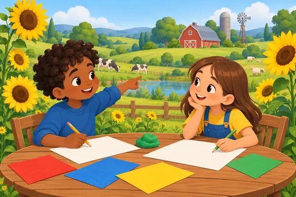
Explore the Farm
Read the notes and study the planning map. Top, bottom, left, and right mean places on the map.
Sunflower Farm Notes
A farm group is making a display of Sunflower Farm. Their notes describe the area as seen from above. A small, round pond lies near the upper left. Land surrounds the pond. A low hill with a smooth, rounded top rises near the upper right. Sunflowers grow on flat land near the lower left.
A narrow stream enters the area from the right edge, below the hill. It runs toward the middle, bends, and continues to the bottom edge. Dry land separates the stream from the pond. The notes do not give water depths or the height of the hill.
The group first draws a planning map. Boxes mark the places, but the real edges are not square. Lightly shaded boxes show water. Unshaded spaces show land. The grid helps place the features; it does not show real distances. Next, the group will build a small model with dough and paper.
- A. A thin pond strip and a round stream patch
- B. A round pond patch and a wide, straight stream strip
- C. A round pond patch and a thin, bending stream strip
- D. A square pond patch and a thin, straight stream strip
The hill rises near the upper right.The pond lies near the upper left.The stream reaches the bottom edge.Sunflowers grow on level ground.
- A. The stream
- B. The pond
- C. Both the pond and the stream
- D. Neither the pond nor the stream
| Land | Water |
|---|---|
- A. Is the pond to the left of the hill?
- B. Does the stream reach an edge of the area?
- C. Is there land between the pond and stream?
- D. How deep is the pond at its center?
Build and Improve a Model
The group will use dough for land and blue paper for water. Choose plans that match the farm notes and map.
- A. Make the hill flat and the field a low mound.
- B. Make the hill a low mound and the field flat.
- C. Make the hill and the field into pointed peaks.
- D. Make the hill and the field equally flat.
- A. Add more blue paper to widen the joining strip.
- B. Move the hill onto the blue joining strip.
- C. Replace the joining strip with a gap of land.
- D. Move the field beside the blue joining strip.
The pond stays to the left of the hill.The field moves above the pond.The stream keeps its bend and reaches the bottom edge.The pond becomes a long strip across the farm.
- A. The hill's place is covered by water.
- B. The hill is taller than the field.
- C. The hill has a smooth, rounded top.
- D. The hill is far from the pond.
- A. Move the pond shape to the right edge.
- B. Make the pond shape smaller around its center.
- C. Move the pond shape into the sunflower field.
- D. Make the pond shape larger around its center.
Check, Explain, and Map
Use the original farm notes for these questions and your drawing.
- A. Look from the side and compare the height of the dough.
- B. Look from above and compare the outlines and places.
- C. Feel the surface and compare how smooth the dough is.
- D. Read the labels and compare how neatly they are written.
Related worksheets
 Worksheet
Grade 2
Two Bus Yards, One Map
Earth & Space Science · 2-ESS2-2
Premium14 questions
 Worksheet
Grade 2
The Dam Viewpoint Map Chain
Earth & Space Science · 2-ESS2-2
Premium15 questions
 Worksheet
Grade 2
The Bike Shop Ground Map
Earth & Space Science · 2-ESS2-2
Premium14 questions
 Worksheet
Grade 2
A Winter Map for the Firehouse
Earth & Space Science · 2-ESS2-2
Premium13 questions
 Worksheet
Grade 2
Land and Water Beside the Lacrosse Field
Earth & Space Science · 2-ESS2-2
Premium14 questions
 Worksheet
Grade 2
A Backyard in Miniature
Earth & Space Science · 2-ESS2-2
Premium12 questions